
LOCAL CYCLING GUIDE / COZUMEL
FIELD GUIDE / REVIEWED 21 SEPTEMBER 2026
Cycling routes around Cozumel.
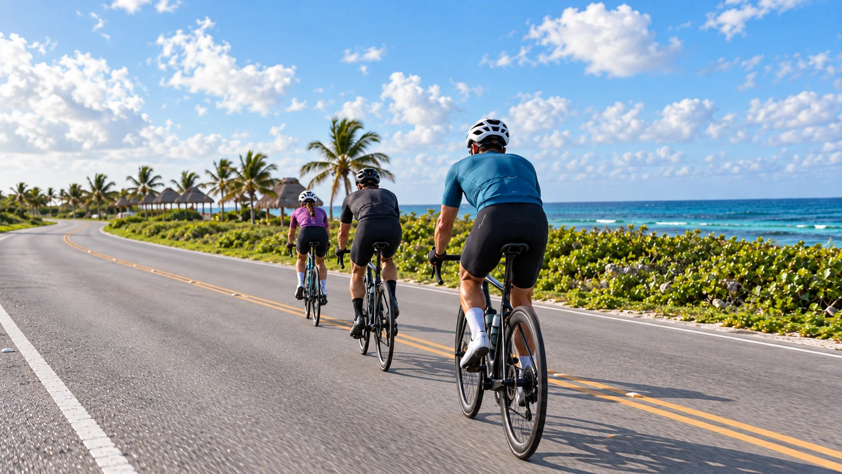
The island is flat, but the ride is shaped by wind, heat, traffic and how far you are from an easy exit. Choose the route for the session, not only for the view.
- Terrain
- Flat / exposed
- Main variable
- Wind + heat
- Standard loop
- South / east / Transversal
- Normal training
- Roads open to traffic
DIRECT ANSWER
Choose by purpose.
Use a coastal or Transversal out-and-back when the workout needs a controlled duration and an easy turn point. Use the full island loop for a longer endurance day only when the athlete, conditions, supplies and support plan all fit the commitment.
- 01
For an activation ride or short aerobic session, stay close to town and turn before the road becomes a logistics problem.
- 02
For steady work, the Transversal is direct and flat, but it still has intersections, local users and changing surface conditions.
- 03
For a long ride, the normal loop runs south from town, around the exposed east coast and back across the island on the Transversal.
ROUTES / DECISION
Match the road to the session.
Distances depend on where you start, where you finish and the exact streets used through town. Set the session by time and route shape; do not borrow a race-map distance and assume it describes an ordinary ride.
01 / FLEXIBLE
South-coast out-and-back
- Best for
- Activation rides, aerobic work and sessions that need a simple early turn.
- Route shape
- Leave town to the south on the coastal corridor; turn when the planned time or conditions say to turn.
- What changes the ride
- Resort, beach-club and access traffic increases along parts of the road. Ride upright through busy sections and keep the aero position for clear, predictable stretches.
- Exit plan
- The easiest option to shorten because the return follows the same road toward town.
02 / CONTROLLED
Transversal out-and-back
- Best for
- Steady endurance or tempo work on a direct cross-island corridor.
- Route shape
- Ride east from town toward Mezcalitos, using the Transversal corridor and turning before the east coast if the session is not a loop.
- What changes the ride
- The municipality documented 13.2 km of cycle infrastructure in both directions. Treat every crossing, entrance and changing surface as active road space rather than a sealed training lane.
- Exit plan
- Simple to reverse, but shade and services are limited once you leave the urban area.
03 / COMMITMENT
Full island loop
- Best for
- Long aerobic work, race preparation and learning how Cozumel wind changes around the island.
- Route shape
- The standard sequence is south from town, around the south and east coasts, then west on the Transversal back toward town.
- What changes the ride
- Flat does not mean easy. The east coast is exposed, wind can change the effective effort quickly, and there are long stretches without a convenient bailout.
- Exit plan
- Commit only with enough water, nutrition, repair capacity and a support or contingency plan for the far side.
04 / SHORT
North-side out-and-back
- Best for
- A short recovery spin or local leg check when staying north of town.
- Route shape
- Use the northern hotel corridor as a short out-and-back and turn before the route stops serving the session.
- What changes the ride
- Hotel entrances, driveways and urban traffic make this a vigilance ride, not a place to hold an uninterrupted aero position.
- Exit plan
- Close to town and easy to shorten, provided the rider stays attentive through the busier corridor.
ISLAND LOOP / COMMITMENT
Flat does not mean easy.
The main loop has almost no climbing, yet it can become a serious endurance session. On the east coast, exposure magnifies wind and heat; on the return through the Transversal and town, traffic and intersections replace the open-road rhythm.
Event maps are useful for understanding the island, but they describe event routing. GFNY currently publishes a 77 km single-loop medium course, while IRONMAN maps a 90 km circuit. Those numbers differ because the events use different starts, finishes and urban routing. A normal training loop is not one fixed official distance.
- 01
Set a time cap and a nutrition plan before leaving town.
- 02
Expect the effective effort to change when the road turns and the wind angle changes.
- 03
Do not depend on race-day aid stations, mechanics or road closures during a training ride.
- 04
Make the first full loop with someone who knows the road or with arranged support.
The hard part of Cozumel is exposure and logistics, not elevation gain.
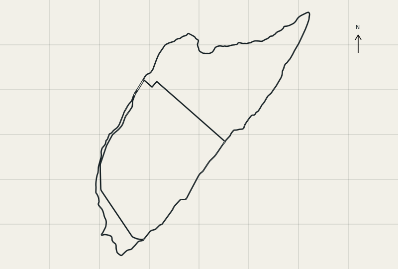
ISLAND SHAPE / ORIENTATION
Coast out. Transversal back.
This map shows the logic of the main road network, not turn-by-turn directions. Use a current route file, check closures and retain a return option.
EAST COAST / WIND
Ride the east side; respect the exposure.
Unlike swimming, cycling on the east coast is a normal part of an island loop. It is also the section where a manageable ride can become expensive in energy. Open sightlines do not remove crosswinds, heat, sand, debris or changing pavement.
Municipal records show that storm damage has required repairs to the east-coast cycle path in the past. That source is historical, not a statement about today’s surface. Check the current road and path condition before committing to the far side.
- 01
Hold the bars securely when the wind is gusty and leave more space between riders.
- 02
Come out of the aero position when visibility, surface, traffic or wind makes control less certain.
- 03
Do not assume every beach business is open or able to refill bottles.
- 04
Carry enough to continue safely if the expected stop is unavailable.
TRAFFIC / POSITION
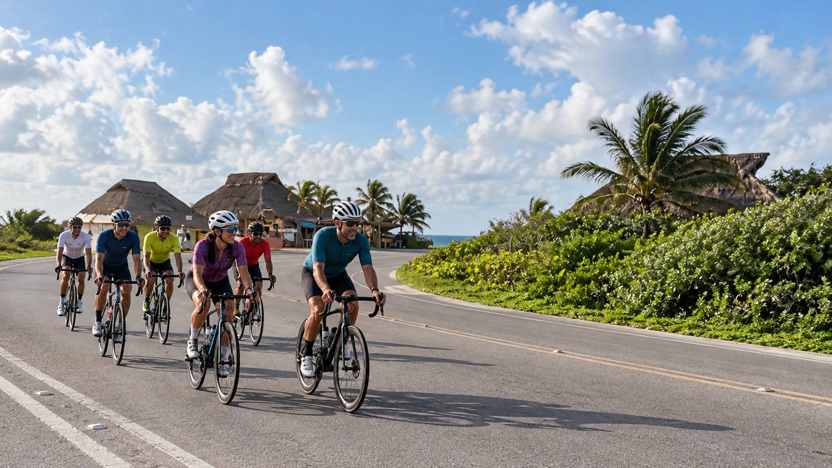
The race course is still a public road.
Outside an organised event, the roads are open to normal traffic. Ride predictably, obey traffic controls and do not train as if cones, marshals or a closed lane will appear around the next corner.
Aero position is a tool, not the default posture for every kilometre. Sit up through town, junctions, driveways, rough surfaces and any section where reaction time matters more than a small aerodynamic gain.
- 01
Use a working front light and a bright, working rear light in daytime.
- 02
Ride single file when the road, traffic or visibility calls for it.
- 03
Signal changes clearly and avoid abrupt movements inside a group.
- 04
Start early enough to manage heat, but only when there is enough light to be clearly seen.
A supported ride adds visibility and backup; it does not turn an open road into a closed course.
BIKE / REPAIR KIT
Carry the repair, not just the plan.
For a short ride near town, a standard flat kit and phone may be enough. For the island loop, bring the equipment and fluids needed to solve routine problems without relying on immediate outside help.
Use tyres and pressures that suit real public-road surfaces. Check bolts, shifting, brakes and hydration storage before the ride, especially after a bike has travelled in a case.
- 01
Carry tubes or plugs appropriate to the setup, inflation, tyre levers and a multitool.
- 02
Bring identification, a charged phone and enough money for an unplanned stop or ride back.
- 03
Save local support numbers before leaving Wi-Fi.
- 04
Do an activation ride after rebuilding the bike; do not discover an assembly problem on the far side of the island.
SCOOTER / SUPPLIES / BACKUP
Supported rides for the sessions that need them.
Tri Tours can accompany an athlete or group by scooter on the main road. The scooter carries planned supplies and basic spares, stays available when the group is stretched out, and adds a visible support presence without pretending the road is closed.
- 01
Water, sports drink and nutrition matched to the planned duration.
- 02
Tubes, inflation and agreed basic spares for the bikes in the group.
- 03
A practical contact point if a rider needs to stop, shorten the route or solve a mechanical issue.
- 04
Local route judgment when wind, heat, road conditions or the group change the original plan.
Scooter support is a safety precaution and logistics service. Every rider remains responsible for bike control, traffic law and riding within their ability.
Ask about a supported rideBEFORE ROLLOUT
Check these before rollout.
Make the route decision again on the morning of the ride; yesterday’s answer may no longer fit.
- 01 / WEATHER
Check wind speed and direction, temperature, rain and any active official warning.
- 02 / ROAD
Confirm current road, cycle-path and event-closure information for the intended route.
- 03 / GROUP
Choose the route for the least experienced rider and agree regrouping points before departure.
- 04 / SUPPLIES
Load fluids, nutrition, lights and repair equipment for the real duration, not the optimistic one.
- 05 / EXIT
Name the turn point, maximum time and what happens if a rider or the weather changes the plan.
EVENTS / CYCLING
Training for a Cozumel bike course?
Use the organiser’s current map for race-specific routing and our guides for local context. Course distance, closures, aid stations and mechanical support apply to the event, not to an ordinary training day.
01
GFNY Cozumel
Current course context, race-week logistics and preparation for the exposed island roads.
Read the GFNY guide02
IRONMAN Cozumel
Full-distance race planning, current bike-course context and practical island logistics.
Read the IRONMAN guidePRACTICAL ANSWERS
Questions visiting cyclists ask.
The practical answer depends on the session, wind and how much support the rider has.
01How long is a loop around Cozumel?
There is no single official training-loop distance. It changes with the start, finish and streets used through town. GFNY and IRONMAN publish different circuit distances because their event routing differs. Plan the normal south–east–Transversal loop by route shape and expected time, then verify the exact file you intend to follow.
02Is cycling in Cozumel flat?
Yes, the main road routes are very flat. That does not make them easy: wind, heat, exposure and long gaps between convenient exits create the difficulty.
03Which direction should I ride the island loop?
The standard local sequence leaves town to the south, continues around the south and east coasts, then returns west on the Transversal. Check current road conditions, closures and wind before using that sequence on the day.
04Can I ride the IRONMAN or GFNY course outside race day?
You can use the public roads that form the course when they are open, but you are not riding under race conditions. There are no guaranteed closures, aid stations, marshals or event mechanics. Follow normal traffic law and the organiser’s current map only as route context.
05Is the east coast safe to cycle?
The east coast is a normal cycling corridor and part of the island loop, but it is exposed. Wind, heat, sand, debris, surface condition and limited easy exits all matter. Check conditions that morning and turn back before committing if the plan no longer fits.
06Can I ride a triathlon bike in Cozumel?
Yes. Use the aero position only where visibility, surface, wind and traffic are predictable. Sit up through town, intersections, driveways, rough sections and group changes.
07Do I need a supported ride?
Not for every short ride. Support is useful for a first full loop, a long or race-specific session, a group with mixed abilities, or any day when carrying enough supplies and spares would be difficult. Tri Tours can accompany the ride by scooter on the main road.
08What should I carry on a Cozumel ride?
Carry visible front and rear lights, fluids, nutrition, a charged phone, identification, money and a repair kit matched to the bike. Add more margin for the full loop because services and easy exits are limited on the far side.
SOURCES / LOCAL RIDES
Primary sources and local guidance.
Official municipal and event sources support infrastructure and course facts. Tri Tours Cozumel provides the practical local guidance on training conditions, supplies and route choice. Conditions and routes still need a same-day check.
LOCAL SUPPORT / COZUMEL
Tell us what the ride needs to achieve.
Send us your dates, accommodation area, bike type, group size and the session from your coach. We can choose the practical route and arrange scooter support with supplies and spares when the ride calls for it.